Now that Carolyn and I are married, we're not only consolidating our dishes, furniture and bank accounts ... we're consolidating our digital lives too! Check out our new website, CramerSpot.com and blog, CramerSpot.com/blog/.
This is my final posting here, so make sure and visit the new site for the thoughts and adventures of the Cramers.
Tuesday, August 19, 2008
Monday, August 4, 2008


Sunday, July 6, 2008
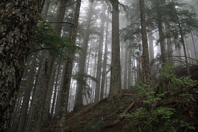
Mount Si Hike
Carolyn and I went for a hike today in North Bend. We climbed Mount Si. The trail is 4 miles long to the top.
View in GPS data in Google Maps
View in GPS data in Google Earth
Round Trip: 8 miles
Time: 3 hours 20 minutes
Elevation Change: 3,240 feet (660 feet to 3,900 feet)


View in GPS data in Google Maps
View in GPS data in Google Earth
Round Trip: 8 miles
Time: 3 hours 20 minutes
Elevation Change: 3,240 feet (660 feet to 3,900 feet)


Monday, June 30, 2008
Bluff Lake Trail and Clear Lake Campground
Doug, Naomi, Ryan, Bob, Alex, Tara, Carolyn and myself hiked Bluff Lake trail which is located near Packwood, WA. We didn't see a single person on the trail ... no cars at the trailhead. This was nice because I was looking for a little used trail.
The trail ended up having a bit too much snow on it. It was hard to follow, so we ended up turning back earlier than I had envisioned. I think it is worth returning to later in the year. With more elevation, I think we would have had great views of the surrounding area. We had a couple nice views of Mount Rainier.
Check out the GPS data here ... View in Google Maps
Here are two panoramas I took from our campground ...

From near the trailhead ...

The trail ended up having a bit too much snow on it. It was hard to follow, so we ended up turning back earlier than I had envisioned. I think it is worth returning to later in the year. With more elevation, I think we would have had great views of the surrounding area. We had a couple nice views of Mount Rainier.
Check out the GPS data here ... View in Google Maps
Here are two panoramas I took from our campground ...
From near the trailhead ...

Monday, June 16, 2008


Thursday, April 3, 2008
Hiking Dog Mountain
 Bob, Ryan, Emily, Carolyn and I went to Dog Mountain for some hiking. The Dog Mountain trailhead is right off of Highway 14 on the Washington side of the Columbia River Gorge. I have read that in the late spring and summer the trail sees heavy use. It is located close to Portland and Vancouver.
I figured hiking this early in the spring we would probably run into some snow on the mountain. We sure did! Quite a bit more than any of us were expecting. We came prepared though. It was very windy for the last mile of the trail. There wasn't much tree cover.
I took my GPS to track our trail. You can view it in Google Earth or on Google maps. The GPS lost signal a few times so there were breaks in the data. I just connected up the end points so it isn't very accurate in some places.
Definitely stick to the right hand trail when going up the mountain. The views are much nicer. We didn't get to enjoy them that much because of the cloud cover though.
Summit: 2,956 feet
Elevation Gain: 2,806 feet
6 miles round trip
After the hike I posted my first "Trip Report" on http://www.wta.org/. I found this website to be a great resource for trail information, so I thought I'd try to contribute a little.

Tuesday, March 4, 2008
Bad Postal Service

I went to the mailbox to get our mail last night. I was expecting to see a Blu-ray disc from Netflix in there for the movie Rent.
To my surprise, it wasn't there. At least that's what I thought at first. There was an envelope from the US postal service that said something about how they try and do a good job sorting and delivering mail without damaging anything ... but occasionally damage does occur.
I opened the package and there was my Netflix movie! Although, not in the condition we usually receive them. I'm not sure what happened, but it looks like someone tried to open the envelope with a chainsaw.
Subscribe to:
Posts (Atom)